
Published paper: Shingle 2.0: generalising self-consistent and automated domain discretisation for multi-scale geophysical models
I have published a new paper on automated spatial domain mesh discretisations in the Journal of Geoscientific Model Development.
- Candy A.S. and Pietrzak J.D. (2017) Shingle 2.0: generalising self-consistent and automated domain discretisation for multi-scale geophysical models, see also arXiv:1703.08504, Geosci. Model Dev..
Summary
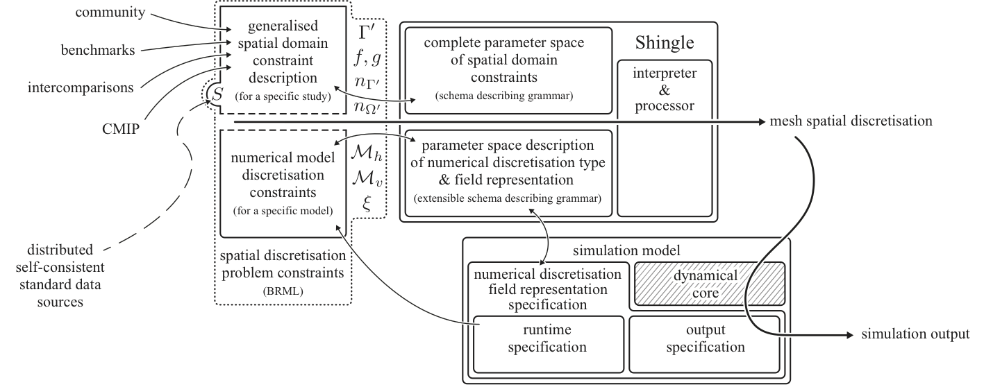
Shingle is a new approach to describing and generating spatial mesh discretisations for multi-scale geophysical domains. Its novel use of an extendable, hierarchical formal grammar and natural language basis for geophysical features achieves robust reproduction and enables consistent comparison between models. This is designed to support the increase in complexity as models include a greater range of spatial scales and future-proof simulation set-up.
Abstract
The approaches taken to describe and develop spatial discretisations of the domains required for geophysical simulation models are commonly ad hoc, model or application specific and under-documented. This is particularly acute for simulation models that are flexible in their use of multi-scale, anisotropic, fully unstructured meshes where a relatively large number of heterogeneous parameters are required to constrain their full description. As a consequence, it can be difficult to reproduce simulations, ensure a provenance in model data handling and initialisation, and a challenge to conduct model intercomparisons rigorously.
This paper takes a novel approach to spatial discretisation, considering it much like a numerical simulation model problem of its own. It introduces a generalised, extensible, self- documenting approach to carefully describe, and necessarily fully, the constraints over the heterogeneous parameter space that determine how a domain is spatially discretised. This additionally provides a method to accurately record these constraints, using high-level natural language based abstractions, that enables full accounts of provenance, sharing and distribution. Together with this description, a generalised consistent approach to unstructured mesh generation for geophysical models is developed, that is automated, robust and repeatable, quick-to-draft, rigorously verified and consistent to the source data throughout. This interprets the description above to execute a self-consistent spatial discretisation process, which is automatically validated to expected discrete characteristics and metrics.
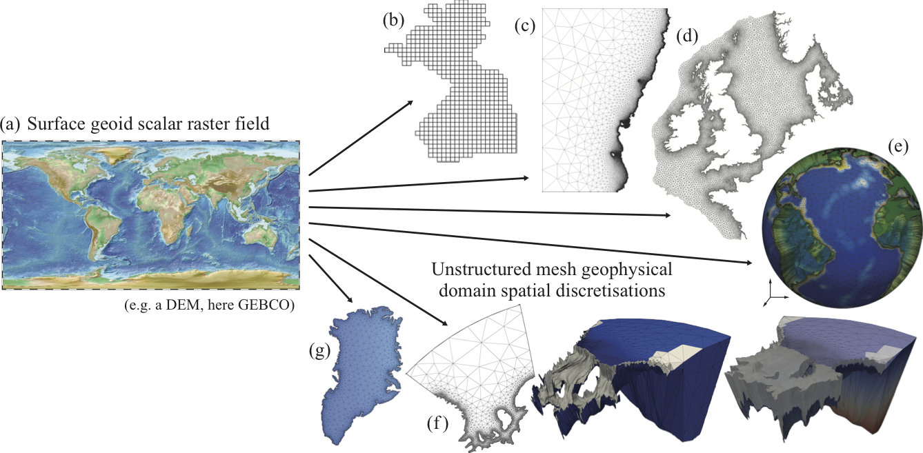
A selection of graphical highlights
Library schematic
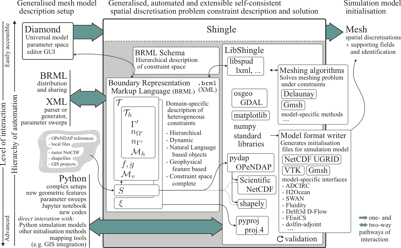
Approach for integration of generalised spatial domain discretisation into geophysical simulation models